Discover the Sacred Valley

Of the Incas
ALTITUDE: 2 972 masl.
DISTANCE: 32 Km
DESCRIPTION
The famous Sacred Valley of the Incas is situated between the towns of Pisac and Ollantaytambo, parallel to the Willcamayu River. You can access it from the city of Cusco. It is composed of many rivers flowing down gullies and valleys, and has numerous archaeological monuments and indigenous communities.
During the Sacred Valley Tour, you will appreciate the towns of Pisac, Yucay, Urubamba, Ollantaytambo, and Chinchero. All these places have pre-Hispanic archaeological ruins that were built by different Inca emperors and used as citadels or resting places. These are ideal places to buy handmade textiles.
This valley was appreciated by the Incas because of its special geographical and climatic qualities. It was one of the main food production sites for the richness of their land and place where it produces the best maize in Peru. All the Sacred Valley of the Incas is also a natural setting, where besides appreciating the archaeological wealth, is an ideal place to enjoy its rich flora and fauna, bird watching, and adventure sports.
The diversity of microclimates allows the production of large numbers of various species of tall flowers that embellish their fields planted with a variety of potatoes, cereals, vegetables and fruit trees and ornamental plants. In the area is common to find deer, chinchillas, viscacha, foxes, Andean pigeons, and lots of birds and beautiful hummingbirds. In the Willcamayu River can fish delicious salmon trout, especially between the months of April to October. All villages are connected by a good road, facilitating his visit.
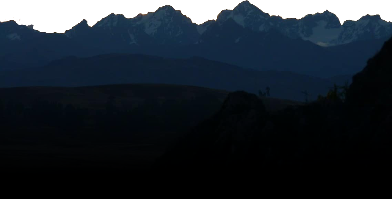
The varied and original scenery of snow-capped mountains, flowering meadows, and deep blue lakes with unique flora and fauna make the Valley the main base for adventure tourism in South America. The Urubamba River passes through Pisaq. In this area the river is not very powerful, sometimes reaching about 25 m wide and gentle though almost all the way, there are torrential sectors used by intrepid tourists for boating.
PISAQ INCA SITE

NAME: Pisaq (partridge bird)
ALTITUDE: 3 400 masl.
DISTANCE: 40 Km
HISTORY
The Inkan City is on the upper side of the mountain, over the well-preserved terracing. It was classical among the Inkas that the most fertile zones must have been reserved for agriculture without being wasted for building towns or cities. Therefore, the city was built taking advantage of the dry and rocky mountain; even more, its location-enabled its protection because this was a fortified city on the way to the Antisuyo (Amazonian Jungle). Historians suggest that it was established over there in order to protect the great capital from possible attacks of the Antis nations that were their worst and never “submitted to” enemy.
Today it is still possible to observe the surrounding wall that protected the most important zone of the city. Moreover, inside the protected area are the vast farming terraces that supplied enough food for its inhabitants in case of sieges or prolonged wars; and there are also aqueducts that supplied water for agricultural development. It seems that water for consumption of the inhabitants was harnessed on the mountain’s upper side and transported through underground channels.
DESCRIPTION
“Kantusraqay” (katu = flower, raqay = roofless house) is one of the groups in P’isaq remaining outside the fortified city, and a bit away from the defensive wall. It is constituted by many buildings with “pirka” type walls, that is, made with non-carved stones and mud bricks that originally had a clay plaster. Over here there are some apartments for non-noble people that must have cultivated the lower terracing; around here there are also some remains of aqueducts and fountains supplying water for people dwelling in the area. From this spot, there is a panoramic view of the terracing that seen from the valley’s bottom look narrow but staying up here one discovers that they are broad.
Following the trail, one reaches the crossroads known as “Antachaka” (anta = cooper, chaka = bridge), where there are some water fountains and a surface aqueduct for the terracing.
Towards the west, on the irregular almost vertical surface of the mountain, there is a large amount of something like hollows: they are looted tombs of the biggest pre-Hispanic cemetery in the region. Today the cemetery is known as “Tankanamarka” (tankay = to push, marka = spot; it may be translated as “hurling spot”), and according to some estimates it must have contained about 10,000 tombs that were mostly looted. In the Incan belief it was stated that once persons died they began a newer life; therefore, their mummies were kept along with all their goods and necessary food. When the conquerors arrived they soon knew that inside the Incan tombs they could also find jewels of precious stones and metals.
Continuing the hike, one crosses the partially destroyed surrounding wall, in which the trapezoidal doorway named as Amarupunku (amaru = snake, punku = doorway) still keeps its lintel. Around there, is the district known as K’alla Q’asa (k’alla = cut, q’asa = pass) also named as Hanan P’isaq (Upper P’isaq); it contains many “pirka” type buildings among apartments, storehouses, towers and so many stairways on the edge of the precipices.
Intiwatana is the most important group in P’isaq, it corresponds to the religious complex of the city that has the best quality constructions with “sedimentary” type walls; that is, with polished-joint carved stones that have a rectangular outer surface. Its location on the mountain’s upper section is superb and dominates visually a great territory of the valley.
In the complex’s central part is a semicircular building with one lateral straight wall which the main gate is toward the south, by deduction and analogy with other similar buildings it is established that this was the Sun Temple in P’isaq. On both side walls of its ascending entrance, there are small hand-boxes carved in the rock that were surely used as holders, like a handrail. By the middle of this building is the altar carved in the in-situ rock, with a central interrupted conical protuberance that is known as “Intiwatana” (“Sundial”; but its original name must have been “Sukhanka”) and must have been used for allowing observation of the solar movements with the help of some other elements or carved angles that served as “pegs” for calculating the shadow projections.
From this sector, there is a trail toward the east in order to go down and visit P’isaqa group that has a somewhat semicircular shape following the mountain’s silhouette. It has a few walls with carved stones, some of the “pirka” type, and some others simply made with sun-dried mud bricks. Over here there are some very well distributed apartments. From the southern end of this sector, it is possible to see on the mountain abrupt surface some circular defensive towers and the adobe storehouses of sustenance goods.
All over the complex, there are farming terraces built even as far as the edge of precipices that still keep their straight sometimes vertical aqueducts and their projecting ladders made with stones that are fit into the retaining walls allowing one to pass from one terrace to the other. From this sector, there is a trail toward the South in order to go down as far as the P’isaq colonial town.
PISAQ MARKET


ALTITUDE: 2 972
DISTANCE: 32 Km
HISTORY
The present-day town of Pisaq was formed after 1572 when the “Indians Reductions” were established, by which the Quechua people were forced to live in villages. The small town was made in the Andean way, with narrow and cobbled streets; but a “Plaza de Armas” and a Catholic Church were established in the classical Spanish way.
In the Plaza, there is a monument sculpted in stone honoring the Quechua Chief Bernardo Tambohuacso Pumayalli, who in 1780 along with some other chiefs and “mestizo” people headed a pro-independence movement against the Spanish crown. The church that is found today is relatively modern; it was made with adobes the same way as the colonial one that was demolished almost completely.
It is in the town’s Main Plaza where every Sunday is the famous “Indian Market” that attracts hundreds of peasants from the surrounding communities who descend from the mountains in order to perform their commercial transactions. Normally, those peasants bring to the market what they grow, goods that are sold or simply bartered for some other manufactures or goods extraneous to their mountains.
The colorful clothing of peasants visiting the market is very showy; those are the clothes of their normal use and not an occasional costume. The native hats are also easy to distinguish; they are almost always black and flat and indicate that their wearers have almost no influence of Western culture and speak just Quechua. Besides, there are many women who wear the “European like” high hats of different colors; they are Westernized and possibly went to school, so they are bilingual or have some knowledge of the Spanish language.
However, this market was also adapted to the tourists’ needs, and a vast sector of it displays handicrafts or “souvenirs” for tourists; in that sector are all the tourist goods existing in any handicraft market in Qosqo. Therefore, nowadays it is possible to find two markets in the same spot: the “Indian” one and that for tourists. Today, a bit scarcer market is also performed on Thursdays.
In general, this is a good place to shop for pottery that is made locally and somewhat old weavings (15 or 20 years). On the other hand, on Sunday mornings, by 11:00 am there is a Catholic Mass in the church for the local population as well as for the community representative called “Varayoq. The mayors’ arrivals to the town are announced by their assistants who blow their “pututos” (trumpets made of big seashells – those trumpets were inherited from the Inkan Society. What is peculiar in the mass is that as attendants do not know or have a poor command of the Spanish language, so the sermon will be said in the Quechua language.
OLLANTAYTAMBO


NAME: Ollantaytambo (lodging place)
ALTITUDE: 2 850 masl.
DISTANCE: 72 Km
HISTORY
Ollantaytambo is a compound Quechua word that is derived from “Ollanta” that is a personal name, and “Tanpu” that refers to lodging for travelers.
Ollantaytambo was a very important fortified city, built as a “tanpu” and also in order to enable control of the roads toward the “Antisuyo” (jungle). According to historians also in order to allow protection of the great Inkan Capital from attacks of the “Antis”, their worst enemies. The typical Incan city did not only have a defensive wall; but, that of a complex city with an ample urban sector and religious temples. As a fortified city, it had some protective elements, among them a protective wall with few entrances surrounding the town, many “pukaras” or strongholds and watchtowers strategically located. Besides, for the noble population in this city, there was a very ample and well planned urban sector, a plaza surrounded by important buildings.
The present-day town is located in the same site where the urban sector was in Inkan times. It is really interesting because it is the only spot in Peru where it is possible to find people living in the same buildings that served as homes for the nobility of the Inkan Society. Some of its narrow streets still keep their water channels where very clean water flowed for the population use; they are by the middle or at one side. The streets still maintain their Inkan names. The town was divided into rectangular blocks with a very well planned geometrical layout giving the impression of being a town designed by modern architects. Today, their thatched roofs were replaced by red tiles and it is possible to breathe a certain air of modernity as the town has electricity and tap water; but in short, the town has still an Inkan taste.
DESCRIPTION
Towards the town’s east is the Pinkuylluna hill (pinkuyllo = wind musical instrument similar to the “quena” or Andean flute) where an imposing huge building stands out and about which there is a lot of myth. Some very imaginative “scholars” argue that it’s been a school, a hospital some others, jail others, and even a hurling precipice!; according to archaeology and the Inkan architectonic characterization it was a “Qollqa” or “Pirwa”; that is, a granary or storehouse for food, clothing, and weapons for local army. It has many doorways and openings that allowed ventilation, and surely they were built up there to enable protection of the stored goods. Likewise, some other smaller buildings are located in outstanding spots or angles of the mountain that served as watchtowers for controlling the movement of persons in the valley.
Toward the western end of the town and crossing the Patakancha stream is the great Plaza, surrounded by sun-dried mud-brick buildings that were very important in their epoch. Towards the west of this plaza is the entrance to the religious sector; in the lower part there are terraces that served for two purposes: they were farming terraces and had an aqueduct by their southern end; likewise, they served in order to stop erosion. Going up through the stairway between the terraces is the 10 Window Temple, which is named that because of the 10 trapezoidal niches existing in its back wall; its front wall was destroyed and today the real duty of that enclosure is unknown. Somewhat higher is the spot of the most important temple: the Sun Temple that was constructed with huge red porphyry boulders. The stone quarry is named Kachiqhata (Salt Slope) and is located about 4 Kms. away on the other side of the valley, by the upper side of the opposite southwestern mountains.
The boulders were carved partially in the quarries, and taken down to the valley’s bottom. In order to cross the river, Quechuas constructed an artificial channel parallel to the natural river bed that served for deviating the river’s water according to conveniences. Therefore, while that water flowed through one channel the other was dry, thus stones could be taken to the other side of the valley. Moreover, the boulders were transported to the upper spot where the temple is erected using the inclined plane that is something like a road which silhouette is clearly seen from the valley’s bottom. They had the help of log rollers or rolling stones as wheels, the power of hundreds of thousands of men.
Today, on the way from the quarry to the temple there are dozens of enormous stones that people know as “tired stones” because it is believed that they could never be transported to their destination; those stones are the reason why some authors claim that the Sun Temple was unfinished when the Spanish invasion happened.
What is left of the Sun Temple are some peripheral walls and the classical major wall that according to most historians is part of the High Altar. It consists of six enormous stone blocks which average weight is about 90 tons and have as vertical joints some other smaller stones making a wall that is unusual in the Inkan Architecture.
It seems that this is a projection of the Tiawanako architecture or possibly the architects were brought from the region of the Titicaca lake, but the final work is entirely Inkan with joints and outer surfaces complete and finely polished and glazed so that they could even serve as mirrors. On the external surface of the fourth boulder, there are three carved stepped symbols that were undoubtedly inherited from the Tiawanakos; they represent the three stages of the Andean World: the “Hanan Pacha” (heaven), the “Kay Pacha” (earth surface) and the “Ukhu Pacha” (underground). Around this same sector there are many other constructions of minor quality (“pirka” type), and with mud brick walls that were perhaps adoratories for minor deities; about which there is not any chronicle or reference.
The streets in this area are very narrow, this fact made many authors believe that it was just a “pukara” (fort).
Toward the north of the religious sector entrance gate is a series of water fountains that because of their location must have performed duties of “Ceremonial Fountains”, that is, used in order to worship the water god. There is one inside a mud-brick square building where water still flows; toward the east of it there is another one baptized by tradition as the “Baño de la Ñusta” (“Princess’s Bath”) that shows stepped moldings in its surface below the spillway. Farther north there are also many other fountains constituting a vast temple dedicated to the cult of “Unu” (water)
CHINCHERO

NAME: Chinchero (Rainbow)
ALTITUDE: 3 750 masl.
DISTANCE: 30 km
HISTORY
The meaning of its original name is lost; although, today tradition knows it as the “land of the rainbow” because over here the K’uychi (rainbow) is frequently seen in the rainy season. As it is known the rainbow was a special deity among Inkas; it had a temple inside the Qosqo’s Qorikancha.
Lamentably, as in most of the towns or temples near Qosqo, Chinchero was wrecked and modified by the “idolatries extirpators”. Its destruction began when Manko Inka after his campaign in Qosqo decided to discharge his soldiers so that they could go back to their farmlands and take care of their families; he went towards Ollantaytambo passing through Chinchero and burning it so that the invaders who were persecuting him could not have either food or lodging. Subsequently, in 1572, Viceroy Toledo founded the “Doctrine of Our Lady of Monserrat of Chinchero” and ordered the construction of the present-day Catholic Church that was finished by the first years of the XVII century; possibly in 1607, that is the year found in the writing over the main arch inside the church.
The whole church was built using as foundations the finely carved limestones that belonged to a great Inkan palace. The entrails of the fine Inkan building were filled up as high as the roofs with earth brought from some other sectors. It was in the 1960s when the Inkan palace was discovered under the Catholic Church. The Inkan palace must have been very important because on its facade facing to the southern plain presents openings of triple jamb that by themselves indicate its category. Farther south from the plain there are two “wakas” (shrines) carved on outcrop limestone formations; today they are known as “Chinkana” and “Titiqaqa”. Towards the west, there is another shrine named as “Pumaqaqa” where it is possible to observe on the in-situ rock sculptures of two pumas which heads were mutilated. Farther west from the mentioned plain there are, even more, a large number of farming terraces that are still cultivated in spite of having lost their aqueducts.
On the southeastern side of the church is another great plaza that today is the town’s Main Plaza. On its western side, there is a wall containing big trapezoidal niches that can easily let a person stand up inside; they must have been used to keep the nobility mummies and idols that presided over ancestral ceremonies. That wall with niches has a genuinely carved andesite cornice. By the middle of this plaza is a bust honoring Mateo García Pumakawa Chiwant’ito who was born in the house located in front of the bust; the house has small arch windows on the second floor. Mateo Pumakawa was Chinchero’s Quechua chief, Official and Warrant Officer paid by the Spanish army; he fought against the Tupaq Amaru II Revolution helping to bring about his defeat in 1781. When being old aged he wanted to repay what he did against his people and race and joined the Angulo brothers in order to fight against the Spanish crown. But, he was defeated and hung from an arch like the ones that are seen in Chinchero, in Sicuani in 1814.
In Chinchero, every Sunday morning there is a nice native market, which is one of the most typical and commendable ones in the region. Over here it is still possible to observe bartering of goods, and almost always people exchange tropical goods such as fruits, coca leaves or salt for some other regional goods such as potatoes, broad beans, ollucos, etc. Also over here, there is a market for tourists with diverse handicrafts with very well-made weavings standing out. Unlike some other markets where merchants are foreigners, over here merchants are native regional people.
SALT MINES OF MARAS

NAME: Maras Salt Mines
ALTITUDE: 3 200 masl.
DISTANCE: 50 km
DESCRIPTION
The Salt Mines of Maras are located 50 km in the northeast of Cusco city, at an altitude of 3,200 m.a.s.l. Geographically, they are located in the lower part of the sub-basin and left bank of the Salineras stream, towards its mouth in the river Vilcanota, in the jurisdiction of the peasant communities of Maras and Pichingoto, between the gorge of the Qaqahuiñay, Cruz Mocco, Llully Mocco and Chupayoq hills. It has three access roads: from the town of San Francisco de Maras, through the bridle path or “runañan” to the salt mines, the road affirmed from the town of San Francisco de Maras, and crossing the Inca bridge of Tarabamba by the Pichingoto community.
The salt mines themselves are constituted by a set of approximately 4,500 salt wells placed in the form of stepped terraces in the middle slope of the hill Qaqawiñay, which has slopes of 20 degrees of inclination to the bottom of the gorge on the left bank of the Salineras stream, with dimensions that vary around 5 linear meters, occupying a total area of approximately 1.5 to 2 hectares.
The terraces are formed by retaining walls of irregular stone seated with mud mortar, forming dikes that delimit the wells as small reservoirs of approximately 5m2. The conduction system of the saltwater from its catchment, is done through a main irrigation channel, which branches out into several small channels that feed the wells. The conduction and maintenance of the saltwater channel is associated with a path that is assumed to be of prehispanic origin due to its layout and characteristics. This technology is similar to that of irrigation in prehispanic agricultural terraces characterized by the conduction and equitable distribution of water. The upper part of the salt mines crosses a road, from the prehispanic time, in the direction of the K’arachaka (Half Moon) bridge. From this road, there are several branches for the circulation between the wells. The set of wells and canals is in perfect continuous operation from the pre-Inca period to the present.
The salt production takes place once a month and is marked by the calendar of the seasons of the year. Thus, in the dry season (from May to October) the accumulation of salt is fast, there is greater production, and a better quality of salt is obtained with a “white or pink color that characterizes commercially this salt”. However, in the rainy season (from November to April) the production is turns out difficult and the color of the salt shows a brown color in several tonalities.
The traditional production process is strictly communal without any external involvement and consists of filling the wells, previously cleaned, with saltwater from a Salineras spring-stream led by a system of canals, up to a height of 5 centimeters then let evaporate for 3 days, repeating this process for a month, mainly during the dry season, period in which it reaches a solid volume of crystallized salt of 7 to 10 centimeters equivalent to 3 or 4 inches in height. The salt extraction is done in layers, obtaining different commercial qualities: the first is known as kitchen salt that is intended for domestic use as well as the second, of lower quality, called bulk salt; while the third is called industrial salt, this serves exclusively for the agriculture, the livestock and the industrial use. The extraction or “harvesting” process includes the salt fragmentation, by using the force of the feet and then proceed to scrape each layer with a small wooden or a small pick and then sift with a strainer and stack the obtained on one side. Once completely dry the salt, this is collected in a basket or container to be then transferred to the warehouse of the communal company Marasal, which is in charge of the classification and commercialization. The profits from the sales are distributed among the owners according to the number of wells they own. Each well produces between 150 and 200 kilos of salt on average per month.
In the salt extraction and elaboration process predominate the traditional social relationships of communitarian type, keeping till the present its traditional way. The salt production system is inherited from parents to children, as it is testified at the present by many elder community people that have worked their wells since they were children as their parents, grandparents and ancestors did.
MORAY

NAME: Moray
ALTITUDE: 3 500 masl.
DISTANCE: 38 km
DESCRIPTION
About 7 kms. (4.3 miles) away southwest from Maras is Moray, a very unique archaeological site in the region. It is possible to reach it by car through the dusty road and the path departing from the town. Those are enormous natural depressions or hollows in the ground surface that Inkas used for constructing irrigated farming terraces around them. What is surprising is that the difference of average annual temperature between the top and the bottom reaches even about 15°C (59°F) in the main depression that is about 30 mts (100 feet) deep. In those natural formations, nature has created an environment, conditions or micro climates that in modern times people create in greenhouses or hothouses. Moray, because of its climate conditions and many other characteristics, was an important center of domestication, acclimatization and hybridization of wild vegetable species that were modified or adapted for human consumption. Therefore, it is a prototype of a greenhouse or experimental biological station, very advanced for its age that helped so that the ancient American Man could leave for mankind about 60% of the vegetable goods that are consumed; so that the Andean Man could consume three thousand different potato varieties, one and a half hundreds of maize, and many other rich goods. Nevertheless, there are still many enigmas about this site, enigmas that rise because of the lack of serious scientific researches that could clear present doubts. Structures found over here are typically Inkan; although, some authors suggest that they are earlier ones, at least in the lower terraces. One of the enigmas is the way how drainage for water flowing through the aqueducts worked; it is suggested that there must be underground channels built by the depressions’ bottom allowing water to drain. It is also argued that the bottom is over a very porous natural rock formation that enables water filtering toward the earth’s interior; the truth is that even today, in the depressions’ bottoms there are no floods neither inundation in the rainy season. It is indispensable to carry out serious palynology studies; that is, divers analysis of the pollen samples that are found in Moray, thus it will be possible to know the nature, species, quality and some other characteristics of the vegetables cultivated over here.